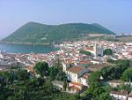
Raminho
Appearance
Raminho | |
|---|---|
 The cliff faces of the northern coast of Raminho | |
| Coordinates: 38°47′17″N 27°19′48″W / 38.78806°N 27.33000°W | |
| Country | |
| Auton. region | Azores |
| Island | Terceira |
| Municipality | Angra do Heroísmo |
| Area | |
• Total | 11.07 km2 (4.27 sq mi) |
| Elevation | 126 m (413 ft) |
| Population (2011) | |
• Total | 565 |
| • Density | 51/km2 (130/sq mi) |
| Time zone | UTC−01:00 (AZOT) |
| • Summer (DST) | UTC+00:00 (AZOST) |
| Postal code | 9700 - 401 |
| Area code | 292 |
| Patron | São Francisco Xavier |
| Website | www |
Raminho is a parish in the municipality of Angra do Heroísmo on the island of Terceira in the Azores. The population in 2011 was 565,[1] in an area of 11.07 km².[2] It consists of the localities Cabo do Raminho and Raminho.


